University of New England deploys research buoy in Saco Bay
 |
|
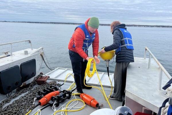
Will Kochtitzky, assistant professor of marine and environmental programs at UNE and Coastal Observation Fellow Elizabeth O'Brien prepare to put a research buoy in the water in Saco Bay on Monday. PHOTO BY LIZ GOTTHELF
|
Tue, Nov 4, 2025 |
A crew from University of New England made up of professors and student researchers braved the cold and headed out on a boat down the Saco River to Saco Bay on Monday morning.
In short time they made it to their destination – about a mile offshore, between Ram and Eagle Islands. There they deployed a buoy. The buoy, branded in blue and white with the UNE logo and bobbing in the water, is equipped with a full range of oceanographic monitoring tools to measure real-time data on wave height, water level, wind, current, dissolved oxygen, and temperature at multiple depths.
“Our objective here is to help increase coastal resilience, and one of the key factors in how much coastal communities are going to be impacted by winter storms is how big waves are. When we get storm system with really big waves, that can be really damaging to our coastal communities and infrastructure – not just dunes and natural infrastructure, but also homes, seawalls, anything that’s along the coastline,” said Will Kochtitzky, assistant professor of marine and environmental programs at UNE.
There are other buoys in Maine that monitor waves, such as the one the National Ocean and Atmospheric Administration further north and further offshore, he said, but there hasn’t been a lot of data collected closer to the shoreline and coastal communities.
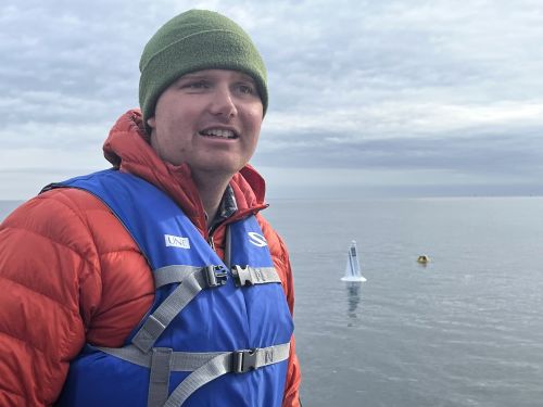 |
Will Kochtitzky,assistant professor in the School of Marine and Environmental Program at University of New England, stands in the university's boat after the buoy was put in the water. The buoy can be seen in the background. PHOTO BY LIZ GOTTHELF |
The Saco Bay buoy will monitor waves as they approach the Camp Ellis coastal community in Saco.
An Army Corps project is in the works for Saco to help offset erosion caused by a more than 150-year-old jetty. The Saco River Jetty, which reaches out into the ocean from the mouth of the Saco River, has caused significant erosion along Camp Ellis and the nearby coastline by displacing wave energy and the natural movement of sand. The 1998 shoreline is 400 feet from where the shoreline stood in 1908, and over time, 38 homes have been destroyed.
“Camp Ellis is, obviously is ground zero, in a lot of ways, for sea level rise and coastal erosion in Maine,” said Kochtitzky.
The buoy will also be a teaching tool for the university, and train the next generation of scientists, he said.
The buoy cost $25,000. More than half the funding - $15,000 – came from Maine Smart, an initiative of the National Science Foundation. The remaining $10,000 was funded through the University.
Data from the buoy is streamed in real-time to UNE’s Sustainable Innovation Center, and can also be viewed online.
Three students selected as Coastal Observation Fellows with the Sustainable Innovation Center will be analyzing the data from the buoy, along with data from monitors at a weather station on Ram Island.
“We’re really excited for the team of three Observation Fellows to take this data and expand upon our monitoring in Southern Maine,” said Emily Wood, Sustainable Innovation Center Coordinator at the University of New England.
Coastal Observation Fellow Jasmin Townsend-Ng, a senior Marine Science major from Vermont, said the buoy is key to research because good data analysis comes from precise data.
“It’s tracking data 24/7. You can get consistent data, so there are no breaks,” she said.
Townsend-Ng said it was a good experience to have access to this data and be able to use it to influence the world outside the university.
Publisher Liz Gotthelf can be reached at newsdesk@sacobaynews.com. Liz Gotthelf works occasionally as a standardized patient at UNE's Clinical Performance Center.